Map of Tollen
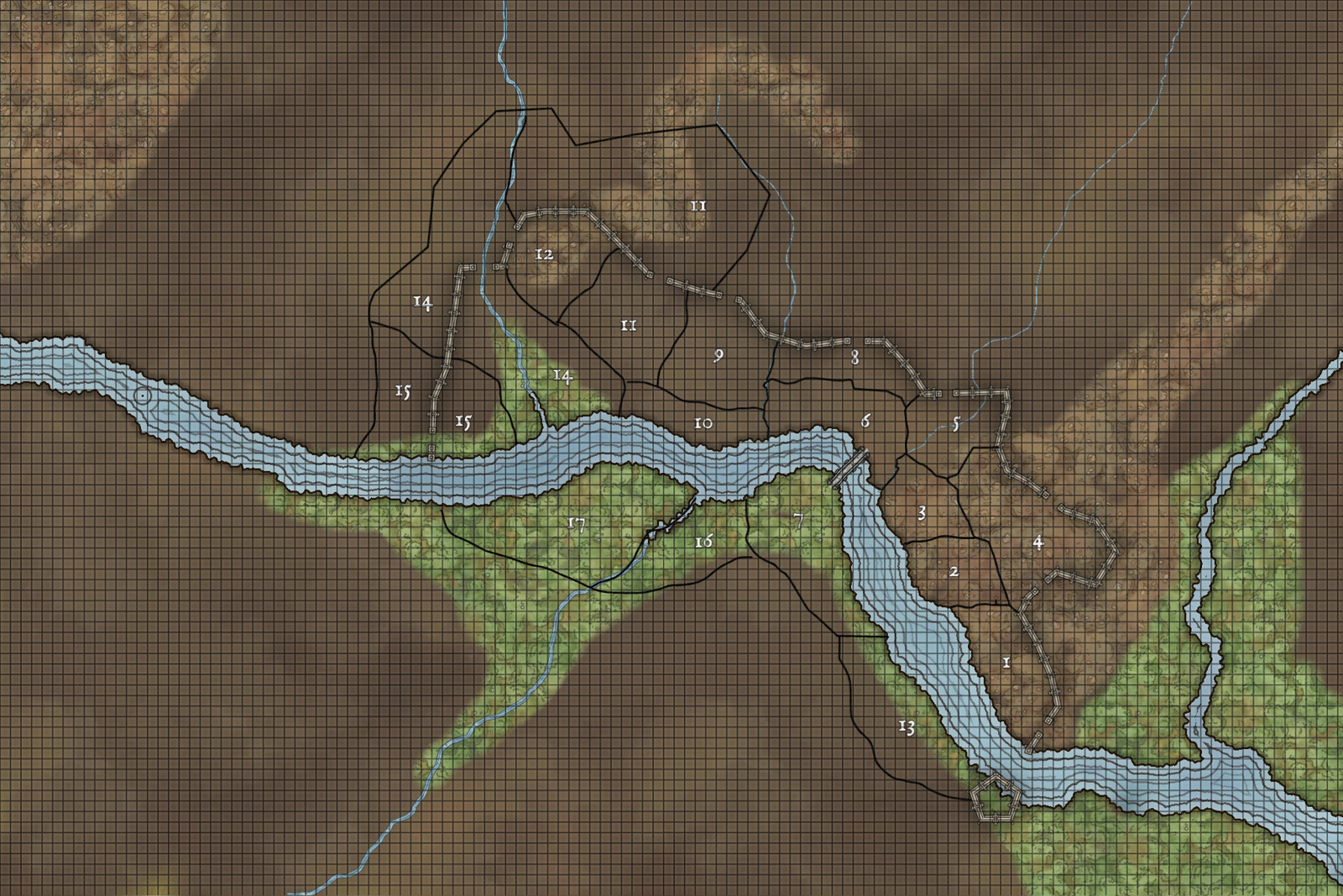
Wards
Numbered from 1 to 17:
1: Skepwalk
2: Fiskurth
3: Aesganstrad
4: Magus Street
5: Nordgate
6: Bridgeward
7: Southbridge
8: Godshome
9: Guildgate
10: Gold Street
11: Fairgate
12: Haurhill
13: Battery
14: Brooklawn
15: Riversgate
16: Fenslane
17: Tideswell
A note about “Inner” and “Outer” wards:
Riversgate, Fairgate, and Brooklawn are split into “Inner” (inside the walls) and “Outer” (outside the walls). Riversgate and Brooklawn were divided when the walls were expanded west; Fairgate Outer grew up around the Fairgrounds (Tollen) north of the city. The boundaries of Outer wards are approximate.
The northern wards (Guildgate, Godshome, Nordgate) and eastern wards (Magnus Street, Skepwalk) are not split into “Inner” and “Outer”. There is little settlement beyond the eastern walls, because of the marshes. The best farmland in the Tollen area is along the banks of the Carnbrook, so north of the northern wards is mostly fields; the small villages in this direction have not been incorporated into the city.
Gates
from east to west
Old Gate
Fort Gate
Scholar’s Gate
North Gate
Temple Gate
Guild Gate
Fair Gate
Tanner’s Gate
River Gate
East Gate
Rivers
from east to west
Greywash
Carnbrook, entirely culverted inside the city
Fat Brook, almost entirely culverted inside the city
Muddy River, channeled and bridged in many places but not covered
Little River, channeled and partially covered in some places
Terrain
Green areas are swampy, though much of this has been drained and reclaimed.
Lighter brown areas are low rises or small hills, the most significant of which is in Haurhill, to the west.